POI - Crucial Data for Location Intelligence Platforms
According to Business Insider around one thousand restaurants opened during the last year in New York City. 80% of them will be closed within the next five years. Therefore, keeping points of interest fresh is an uphill challenge but is crucial for any location intelligence platform.
On the other hand, having fresh data is not enough without worldwide coverage of the POI.
Integrate the World’s Leading Sources of POI Into Your Platform
Whether you are looking to populate, update, or benchmark your platform’s dataset against top competition, Outscraper is an all-in-one solution. We focus on integrating top public sources of POI into customers’ platforms.
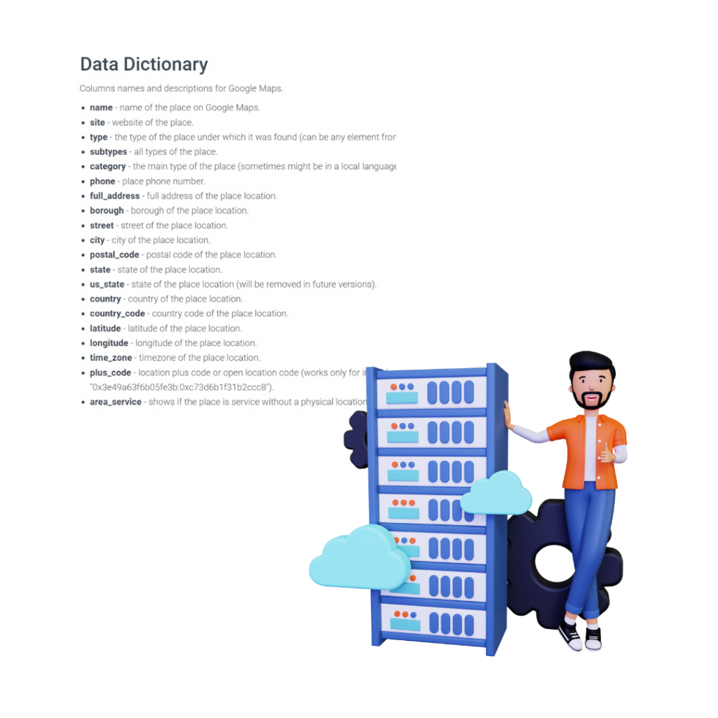
Since Google Maps is the very first stop for any new entrepreneur for promotion, it became a truly worldwide real-time POI database. Paired with other data sources it can fully fulfill your POI needs.
POI Delivery Options
Talk To Sales
使用Outscraper进行定位智能的主要优势
告别筛选不相关的记录,向高效和有效的数据集问好。
Outscraper使您能够轻松地只检索您需要的兴趣点(POI)数据。凭借其 高级过滤能力你可以针对特定的类别、地点和其他标准,以确保你收到最相关、最有价值的数据,满足你的业务需求。


常见问题
最常见的问题和答案
The term “POI” stands for “Point of Interest.” When referring to the “POI of a location,” it typically means a specific point or place within a given location that is of particular interest or significance. This could be a landmark, facility, attraction, or any other notable spot.
For example:
- In a city, the POI could be a famous monument, a museum, a popular restaurant, or a historic site.
- In a national park, the POI could be a specific viewpoint, a waterfall, a trailhead, or a camping area.
In the context of navigation and mapping, the POI of a location would be a specific point that users might want to visit or navigate to. It would typically be represented with a marker on a map and might include additional information like its name, description, and other relevant details.
Here’s a concise version of the benefits of POI location data:
- Navigation: Guides users to specific destinations in GPS devices and apps.
- User Experience: Helps users discover nearby services or attractions.
- Business Decisions: Assists in location-based decision-making for businesses.
- 营销: Enables location-based promotional targeting.
- Urban Planning: Informs infrastructure and public service development.
- Tourism: Recommends attractions and services to travelers.
- Real Estate: Provides insights on nearby amenities for buyers/renters.
- Emergency Response: Helps locate essential services quickly.
- Research: Aids in urban and socio-economic studies.
- Augmented Reality: Enhances real-world views with POI overlays.
In essence, POI data enhances navigation, decision-making, and user experiences across various sectors.
In maps, “POI” stands for “Point of Interest.” It refers to specific locations or destinations on a map that might be of particular interest to users. POIs can include places like restaurants, gas stations, tourist attractions, hospitals, parks, and more. On digital maps or navigation systems, POIs are often represented by icons or markers, and users can select them to get more information or directions to that location.
Location intelligence data involves analyzing geographic or spatial data to derive insights for decision-making. Key aspects include:
- Data Sources: GPS, satellite imagery, census data, etc.
- Spatial Analysis: Examining patterns and trends in geographic data.
- Visualization: Using tools like GIS to display data on maps.
- Applications:
- 商业: Optimal store locations.
- Urban Planning: Infrastructure development.
- Healthcare: Tracking disease outbreaks.
- Real Estate: Assessing property values.
- Environment: Monitoring land use changes.
- Transportation: Optimizing delivery routes.
In essence, location intelligence helps in making informed decisions based on geographic data.
POI mapping refers to the process of plotting and visualizing Points of Interest (POIs) on a map. These POIs can be any specific locations or destinations that might be of interest to users, such as restaurants, gas stations, tourist attractions, and more. In the context of digital maps or navigation systems, POIs are often represented by icons or markers, allowing users to easily identify and access information about these locations. The primary goal of POI mapping is to enhance the user’s understanding and navigation of an area by highlighting key places of interest.