目次を見る
What is Mapping and Location Industry?
Mapping and location industry refers to the collection, analysis, and dissemination of spatial data and geographic information. This industry includes a wide range of companies and organizations involved in creating, managing, and utilizing mapping and location-based technologies, such as geographic information systems (GIS), satellite imagery, and location-based services (LBS).
Mapping and location industry is an important aspect of many fields, including urban planning, transportation, public health, natural resource management, and emergency response. By utilizing spatial data, businesses and organizations can gain valuable insights into patterns and trends related to location, which can inform decision-making and improve operational efficiency. The industry is constantly evolving and innovating, with new technologies and applications being developed to further enhance our understanding of the world around us.
Companies in this industry source data from a variety of places, including government agencies, private companies, and crowdsourced data. Private companies such as Google and Apple also provide mapping and location-based services that generate data from user inputs and device sensors. Additionally, data can be crowdsourced from individuals and businesses through platforms such as OpenStreetMap.
How to Use Google Maps Data for Validation and Enrichment?
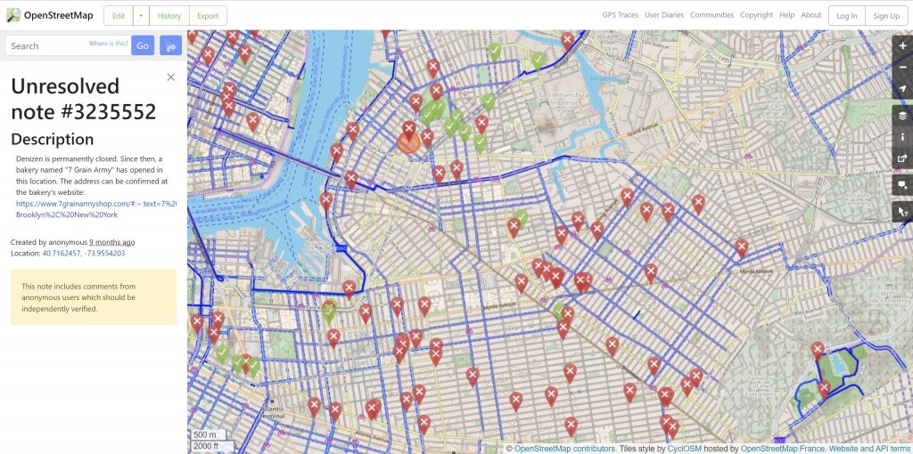
It’s always reasonable to use open sources like OpenStreetMap when doing a project. Since the data flow on these platforms is voluntary, it may be partially incomplete, unresolved, or out of date.
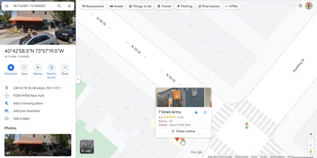
In these cases, choosing Google Maps for validation would be the right choice. Road and place data are the primary sources of information used when validating and enriching with Google Maps data. Google Maps constantly optimizes directions and identifies problematic points of interest (POIs), thanks to its millions of active users.
Google Maps data includes information such as place names, addresses, geographic coordinates, and ratings/reviews. It is possible to search for the location to be validated on Google Maps with the name and coordinates.
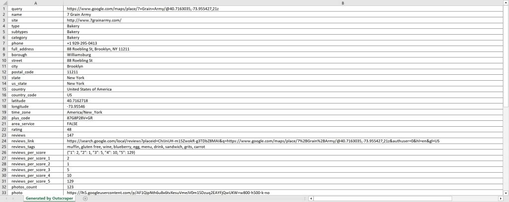
By locating the relevant business on Google Maps, the point of interest (POI) can be validated and enriched with over 40 additional data points provided by Google Maps. Their descriptions can be found in the “データ辞書“.
Although there are various ways to extract Google Maps Data, it takes too long to do it manually, one by one. In mapping projects that need very large datasets, it is not possible to solve them in this way. It is necessary to automate the work. Online services such as Outscraper Google Mapsデータスクレイパー allow to automatically download Google Maps Data according to parameters.
Using Outscraper to Extract Google Maps Data
Outscraper is a user-friendly online service that makes data crawling easy and effortless. Creating a task is simple: you just need to the set the basic parameters. The task runs in the background and automatically crawls the data, making the process effortless.
The “Googleマップをスクレイピングするには?” tutorial provides a comprehensive guide on how to use Outscraper for Google Maps data scraping. Outscraper offers advanced filtering options and an API service for users who want to take advantage of its services at an advanced level.
In Outscraper, besides Google Maps Data Scraper service that can extract places, there is also グーグルマップトラフィックエクストラクタ service where you can scrape directions and traffic data. Thus, it is also possible to validate roads and directions in mapping projects.
It is free to test Outscraper services by registering with a work email address. Test tasks can be created in the フリーランナー. Let’s try the Google Maps Data Scraper service now.
よくある質問
最も頻繁な質問と回答
To use Google Maps for projects, you can extract relevant data such as place names, addresses, geographic coordinates, and ratings/reviews by utilizing Google’s APIs or services such as Outscraper Google Mapsデータスクレイパー. The data can be used for validation and enrichment, providing valuable insights into patterns and trends related to location.
Google mapping process involves utilizing various mapping and location-based technologies, such as geographic information systems (GIS), satellite imagery, and location-based services (LBS), to create, manage, and utilize spatial data and geographic information. Google also offers mapping and location-based services that generate data from user inputs and device sensors, which is constantly optimized and updated to provide accurate and up-to-date information. Services like Outscraper Google Maps Data Scraper can also be used to extract and automate the process of gathering data from Google Maps.
Yes, Google Maps is a mapping platform that provides a vast amount of spatial data and geographic information, including place names, addresses, geographic coordinates, and ratings/reviews. It is one of the most popular and widely used mapping and location-based services, utilized by businesses and organizations for a wide range of purposes such as new store locations, delivery route optimization, customer behavior analysis, and more. Outscraper also offers services such as Google Maps Data Scraper and Google Maps Traffic Extractor, which allow users to extract and validate data from Google Maps more efficiently.


0のコメント